-

-

Prato sull'Arno
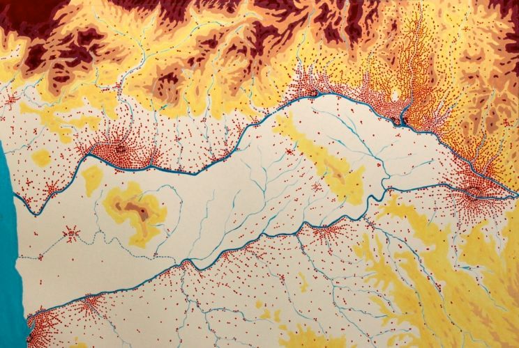
2010 (Acrylic/44.5 X 29.5cm) #10007 Here is my version of Central Tuscany in 2010, the project having been in bloom for four centuries now. The diverted Arno is the southern canal; the main canal is on the north. The little shriveled town in the middle is Pisa; and the dotted line running through it, the original course of the Arno. With the subservient Pisa locked-in and the canals as a defense, no one wanted to live there, yet Florence (the city on the east at the juncture of the two canals) and its allies along the main canal flourished. Nearest to Florence is Prato, then Pistoia, then Lucca. I had to plan the larger, unbuilt canal myself. My calculations showed the best elevation to be sixty meters. It required the fewest locks, the shortest tunnels to dig, etc. The map is drawn on vellum, traced from a government geological map. Therefore the topographical contours are true-to-life, but the way the cities have grown over time is my own speculation.
-

Leonardo Niccolò e l'ArnoPrato
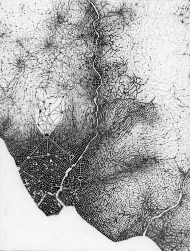
2010 (Black ink on vellum/25.5 X 19.5cm) #10006 Prato, 2010, on the North Canal. I must now inform Niccolò and Leonardo that, in truth, Florence is not ideally situated to be the major port they envisioned. On the other hand, Prato is. So in my alternate history, it surpasses Florence to become the leading city of the Renaissance. Now it is Prato, not Florence, that was bankrolling Europe’s courts and wars. A succession of overextended French kings made the smart choice to marry their bankers’ daughters. Look carefully and you will notice the grand Versailles-like palace they built for themselves, as well as the huge basilica that had to be constructed when they “requested” the Pope and his court relocate here.A beautifully researched book on this subject is “Fortune is a River: Leonardo Da Vinci and Niccolo Machiavelli's Magnificent Dream to Change the Course of Florentine History” by Roger D. Masters.