-
-
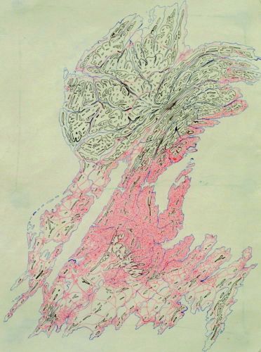
Fjord
Fjord. 1974 (Ball point pen on paper/16.2 X 22 cm) #74001
-
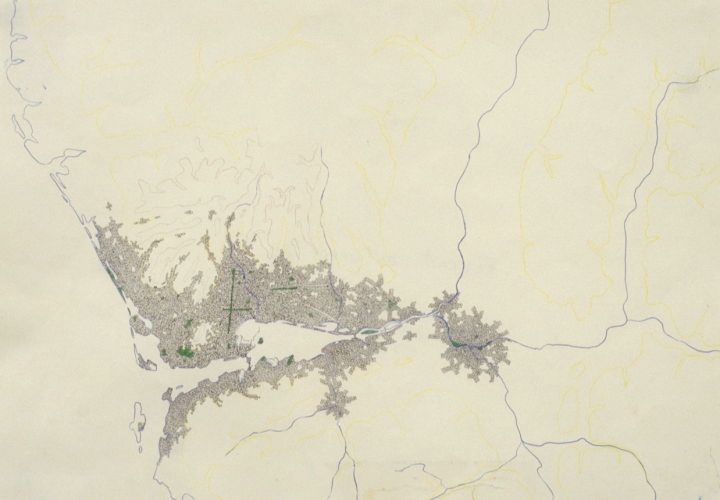
City by the Bay
City by the Bay. 1974 (ballpoint pen & pencil on paper/21 X 29.5cm) #74003
-
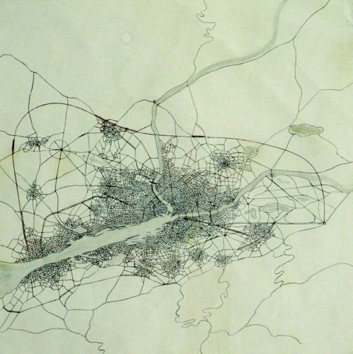
Long Harbor
Long Harbor. 1974 (ballpoint pen & pencil on paper/21 X 21 cm) #74004
-
-
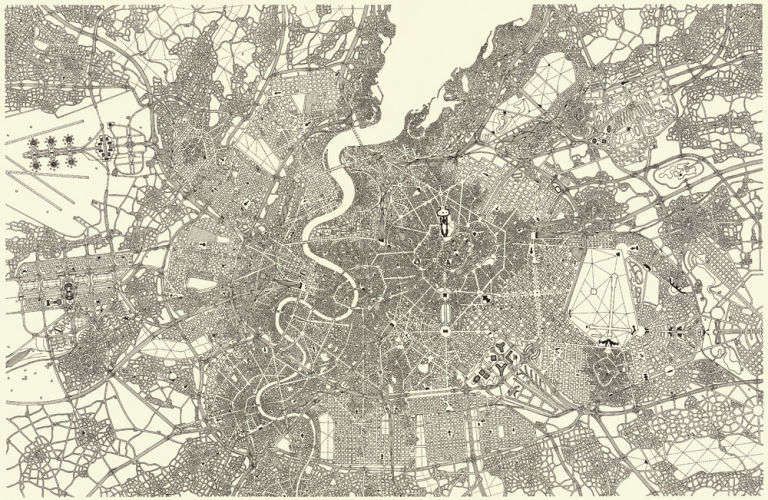
Old World
Old World. 1976 (Black ink on paper/30.5 X 47cm) #76003This hypothetical European city, circa 1976, began as a typical medieval town. At the very center, of course, was the castle of the king. You will see that as the city grew, a second wall for fortification had to be built and the palace expanded. As civilization advanced, the merchant class, mainly Jewish, took root by the port; also, fortifications could be torn down. Those wide spaces became the natural place to put broad boulevards connecting the growing city’s neighborhoods, as in Vienna or the cities of France. There are also 20th Century influences, such as a planned city that references Canberra, Australia’s capital, built in 1915. All these laws of urban growth and layers of history are present in every city’s map -- whether it is Baghdad or Brazilia.
-
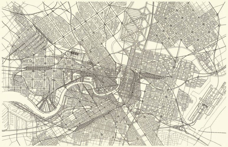
New World
New World. 1976 (Black ink on paper/30.5 X 47cm) #76004 You can identify a young, New World city though several key features: lots of motorways and intersections for a car-obsessed culture, no artifacts of old city walls (which newer, democratic countries never needed) and a predominant grid pattern. At the moment I began conceiving a “New World” city, I discovered a fabulous ruler with which you can precisely draw parallel lines. Perfect for my New World! I was off and drawing.My map is a take-off on Washington, D.C. and the creation of a new, planned capital for this fictitious country. Like D.C., it, too, is designed by a Frenchman, with grand boulevards leading to a center point and with grids sandwiched in-between the spokes. I also knew that I wanted this to be the major port of the country, but surprised myself when the riverfront began to show strong influences of London’s docks, with its 19th Century roots. And, of course, my passion for mass transit comes heavily into play with train
-
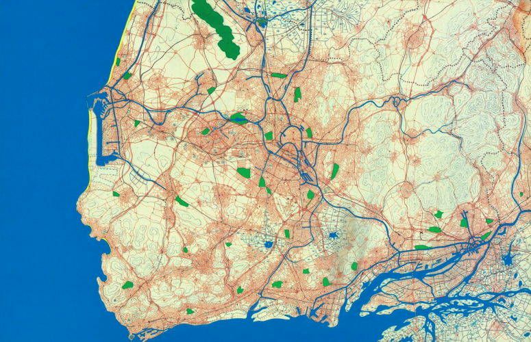
Lowlands
Lowlands. 1976 (Ballpoint pen, pencil, gouache on paper/30.5 X 47cm) #76005 I am fascinated by the urban agglomerations of Western Europe, like the Ruhr district of Germany or those in northern France. Unlike previous urban sprawls, which developed along geographical features like coastlines, rivers or valleys, the manufacturing towns of the Industrial Revolution spread along an invisible geological feature, ores lying deep beneath the surface.My version is influenced by the Benelux countries and by the decision that my lowlands would have once been rich with underground coal and iron deposits. Beginning in the industrial era, a string of cities would naturally have taken root here for mining and processing. Each kept growing until they joined into one massive spread, reaching a dead end in the mid-seventies, when steel-making became obsolete in Western Europe. In the map, I first drew the lines of the elevation, then came the swamps and the slagheaps that mark where the mining is taking place
-
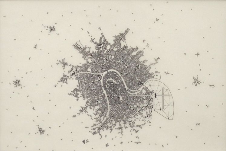
Bend in River
Bend in River. 1978 (pen & ink on vellum/20 X 29cm) #78001A study to illustrate the typical evolution of a town founded because of its natural defensive geography: a river bending around a promontory. A castle or fort would first be established because of the hilltop’s vantage point as well as the three-sided “wall” of water (providing only one direction of access for an aggressor). My castle gave rise to a French medieval town, which filled the loop of the river. This grew into an aristocratic stronghold, where the king eventually built one of his country estates. Once the defensive walls were no longer needed, it was redesigned in The Grand Manner (you’ll notice my several Places d’Etoiles). And finally, in 1978, here is a 20th Century city of 100,000. This is the first piece I did in ink on vellum, and I discovered the dream-like quality it evokes. I drew the city block-by-block. With this technique, the river or a street only appears as the spaces between those blocks are drawn to define it
-
-
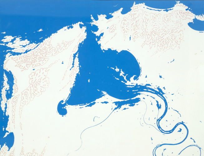
Uninhabited Bay
Uninhabited Bay. 1978 (silkscreen/47 X 61cm) #78002. A first screen defined land mass from water, blue over white paper. A second screen created the elevation lines in red. Although it wasn’t planned, the unchartered land came out looking a bit like San Francisco Bay.
-
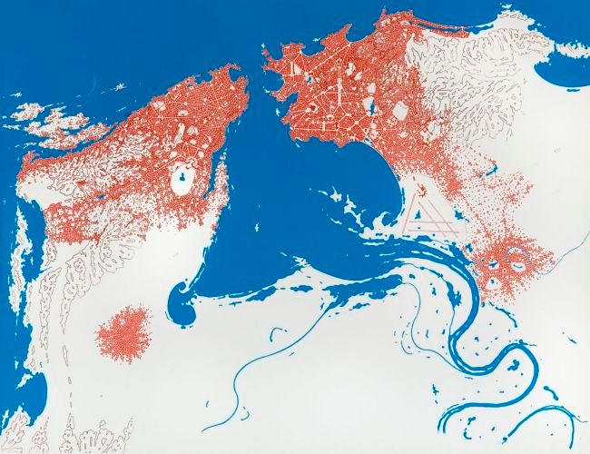
Rome sur Mer
Rome sur Mer. 1978 (Gouache on silkscreen/47 X 61cm) #78003A For humans settling the terrain of my Uninhabited Bay, their smartest move would be to establish a fortified village on a high hill near the entrance to the bay. Others soon built on nearby hills. By the seventh hilltop settlement, the fate of this city was sealed. A Rome of some kind was gestating.Over my hyper-accelerated span of centuries, I began incorporating some of Rome’s layouts, perspectives and iconic spaces. (You’ll see St. Peter’s and Piazza Navona along with many gigantic churches.)
-
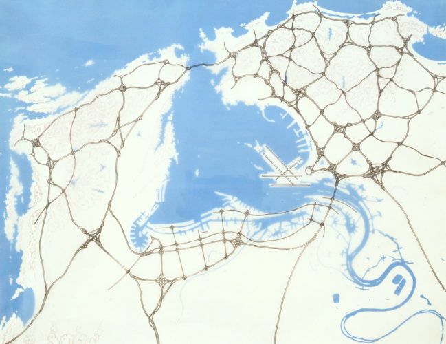
Freeway
Freeway. 1978 (pen & ink on vellum over silkscreen/47 X 61cm) #78004 The Uninhabited Bay has been reconfigured à la Hong Kong. I dredged along the bay and river’s shores to create the world’s largest port. With the dredged mud, I built embankments and breakwaters, as well as an artificial peninsula for a new international airport. I doctored my own print by using blue gouache to paint directly over the white land and white gouache over the blue water. The next logical step was to complete the infrastructure with an expressway network and the airport landing strip. Like an urban planner, I drew these on a vellum overlay.
-
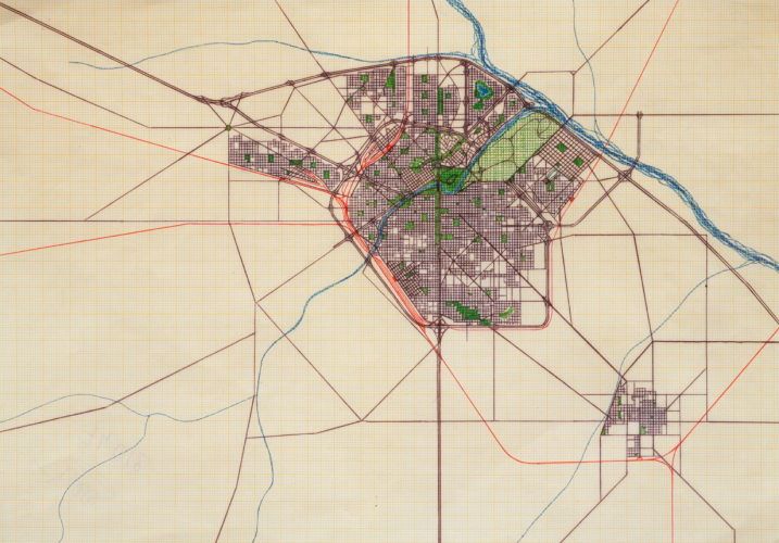
State Capital
State Capital. 1982 (ballpoint pen & colored pencil on colored graph paper/22 X 30cm) #82001
-
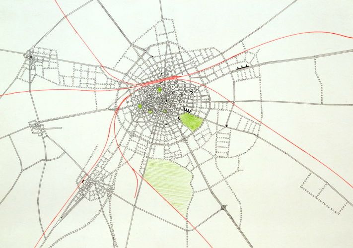
In Progress
In Progress. 1982 (pen & ink & colored pencil on white board/19 X 26cm) #82002
-
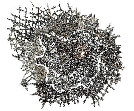
Medina
Medina. 2002 (Ink on vellum/27.5 X 34.5cm) #02001 This medina is based on the principles of the old Arab towns I began experiencing with my first trip to Cairo at the age of twelve. In the chaos of life there, you will happen upon a peaceful, sacred space, respected whether it is walled-in or not. I wanted to construct a medina that was my own, dotted with mosques in the middle of crazy, endless mazes. From above, the open white spaces of the mosques nesting within the cramped, twisted lines of the alleys perfectly convey the equipoise of the two energies.