-
-
St. Martin's
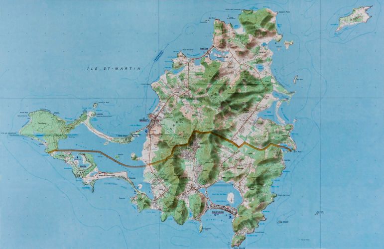
ST. MARTIN'S. Original French IGN Map, as published, unaltered
-
St. Martins, Isle of St. Martin's
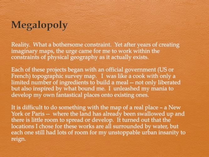
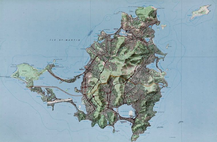
1993 (Rapidograph, black ink on IGN Map/55 X 84cm) #93003BVisiting friends on the island of St. Martin over a period of 20 years, I was fascinated by the explosive population growth from 25,000 to 100,000. I decided to take it much further and transform it into a "Hong Kong," with a population of 1.5 million and with freeways ringing the island, tunneling east-to-west and north-to-south. This turned into the most involved map I have ever done, taking a year to complete.On April 1st in 1997, my friend, the editor of St. Martin's Week, published the map, with the caption “Révélation d'un plan global d'urbanisme pour 2005," basically announcing it as the French Ministry's official plan for the massive overdevelopment of the island by 2005. Calls came flooding in. Only instead of being horrified, people were more concerned with how the plan would increase their property values.
-
Tuckernuck Island
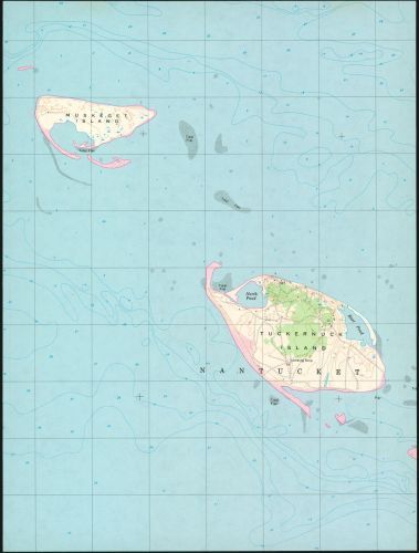
Original US Geological Survey MapMap, as published, unaltered
-
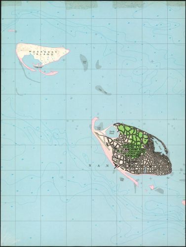
The Isle of Nan (Tuckernuck Inhabited)
1993 (Pen & ink on US Geological Survey Map/37 X 28cm) #93001BI am often drawn to work with a location because I know it through experience or simply because I like the map. The coastlines of the Cape Cod area in Massachusetts have beautiful configurations. I saw this map of Tuckernuck Island, a part of Nantucket, which I found exquisite...but also extremely boring for inhabitants. Can you magine being stuck there? It needed a major change. In my Tuckernuck, the Massachusetts government saw the rewards of allowing gambling in this one spot. The tourist industry would flourish, and gaming operations could be heavily taxed. You can see how the new, enterprising “Isle of Nan” exploded through my grand design. Tuckernuck became “The Isle of Nan” because I gave myself the challenge of incorporating any text or graphics into my map to keep it “pretty.” If mountains and canyons don’t stop me, surely some printed text can’t -- as long as my development follows the geometry of the letters.
-
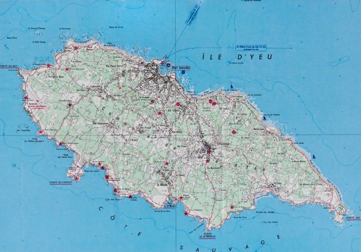
Isle d’Yeu
#93002AOriginal French IGN Map, as published, unaltered
-
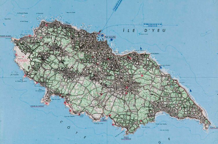
Isle d’Yeu (The Latest Monaco)
1993 (Pen & ink on IGN/28 X 40cm) #93002BGambling makes any place explode. Isle d’Yeu is an island off the Atlantic mainland of southwest France, near where I grew up. A lazy place with sandy cove beaches, it can be accessed only by boat or helicopter. In it, I sawthe potential to become the “Monaco of the Atlantic.” I was happy to supply it with everything it needed -- casinos, hotels, a conference center, airports and an influx of workers of all levels to provide lots of life and luxury.
-
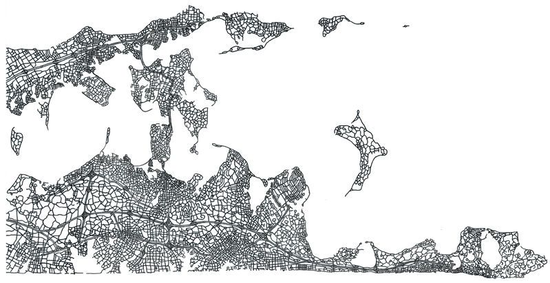
The Forks
2004 (Ink on vellum/27.5 X 34.5cm) #04002“The Forks” came about because I published an art and literary webzine from 2002-06 called “Papotage” (a French idiom for “idle chatter”). Each issue had a theme and guest contributors. Because it began as an outgrowth of my restaurant, one issue examined “The Fork”...and did it from many crazy angles. My contribution was this lace-like map of the eastern end of Long Island, where it splits into its "North Fork" and its “South Fork” (where The Hamptons are). For forty years now, both locals and weekenders have been screaming and/or whining about overdevelopment as they continue to, well, over-develop. A deeper cause of the mess is MIS-development. For instance, they insist on keeping their main artery a quaint, two-lane country highway -- guaranteeing it turns into a nightmare during the 100,000 population burst every summer. What if the warring factions aligned to create a true infrastructure for growth rather than being so feebly schizophre