-
-
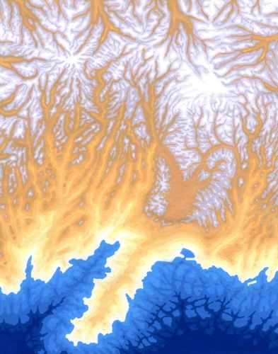
Andorra Elevation
2010 (acrylic on paper/17.5 X 13.5cm) #10001 The topographical map of Andorra.
-
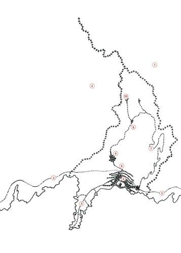
Andorra Schematic
2010 (Black ink on vellum/17.5 X 13.5) #10002A black and white schematic of the topographical map, showing the country’s borders and its primary man-made features (roads, settlements, etc.); the book's page had a key at the bottom.
-
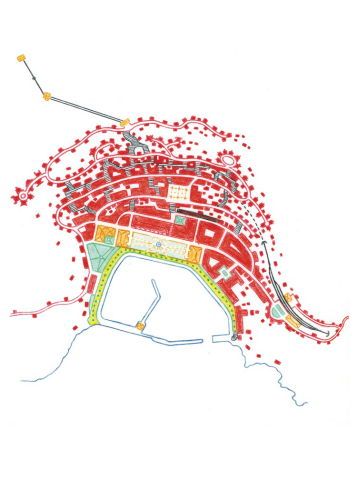
La Plata Colors
2010 (Colored pencils/19 X 17cm) #10003 The harbor/main area of La Plata, Andorra’s capital and largest city, in diagram. The buildings are in red. Bracketing the main square are the two public buildings, the municipal building and the opera house. Facing the harbor are the Hotel Excelsior and the shopping arcades.
-
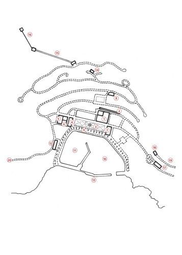
La Plata Schematic
2010 (Black ink on vellum/22 X 18cm) #10004 A black and white diagram to show only the streets of La Plata, along with the important buildings, which were noted in a key at the bottom of the page.
-
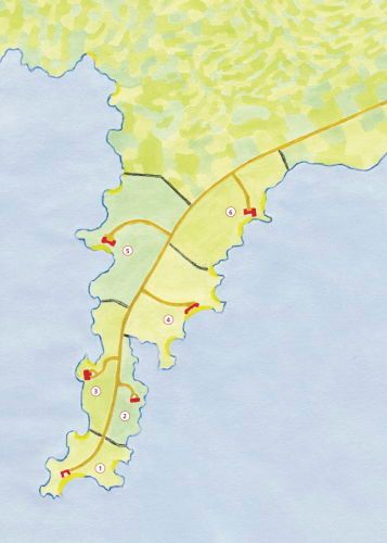
Peninsula
2010 (acrylic on paper/17.5 X 13.5cm) #10005 Andorra’s peninsula is made up of five estates, all property of the country's long-estabilshed families, except for the one on the tip which had to be sold and is now a private beach club.For this piece, I watered down acrylic colors to lighten them and create an effect of water colors.